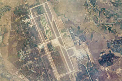
Newly released satellite images have exposed the full extent of devastation in Myanmar following a powerful 7.7-magnitude earthquake on Friday. The images, captured by Planet Labs and Maxar Technologies, show widespread destruction across central Myanmar, where entire neighborhoods have been reduced to rubble.
In Naypyidaw, Myanmar’s capital, satellite comparisons reveal the control tower at the city’s international airport in ruins, a stark indicator of the earthquake’s force.
In Mandalay, one of the country’s largest cities, once tightly packed residential blocks have been flattened, with only the grid-like roadways providing clues to what once stood there.
The earthquake, Myanmar’s strongest in over a century, comes as the country struggles with the ongoing civil war and international isolation since the military coup in 2021.
Experts warn that while these satellite images provide a glimpse of the destruction, the full impact of the disaster may take weeks to assess. Rescue teams continue their search for survivors amid the rubble, but damaged infrastructure and limited resources are hampering efforts.


